

TERRITORY MANAGEMENT
Structure Your Coverage Region by Region, Not Spreadsheet by Spreadsheet.
BizzField CRM models your coverage as a real four-level hierarchy — Region, State, City, Area — so every Lead, Contact and Account is tagged consistently and every territory report actually rolls up.
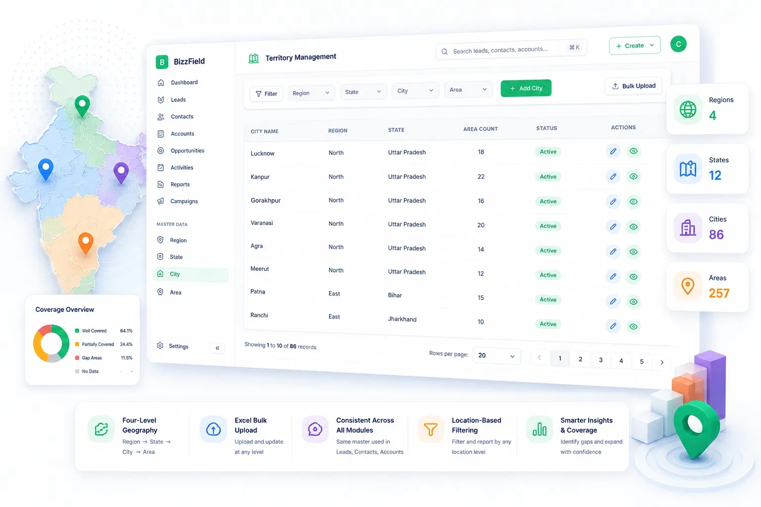
Territory Coverage, In Numbers
Before the workflow, the shape of what one geography master gets you: four levels, three modules, zero drift.
Every Sheet Spells Your Territory Differently
Without one geography master, coverage data drifts apart the moment more than one person touches it.
How BizzField CRM Structures Coverage
Four capabilities that turn geography into structured, filterable data instead of free text.
Region, State, City, Area
Four-Level Geography Master
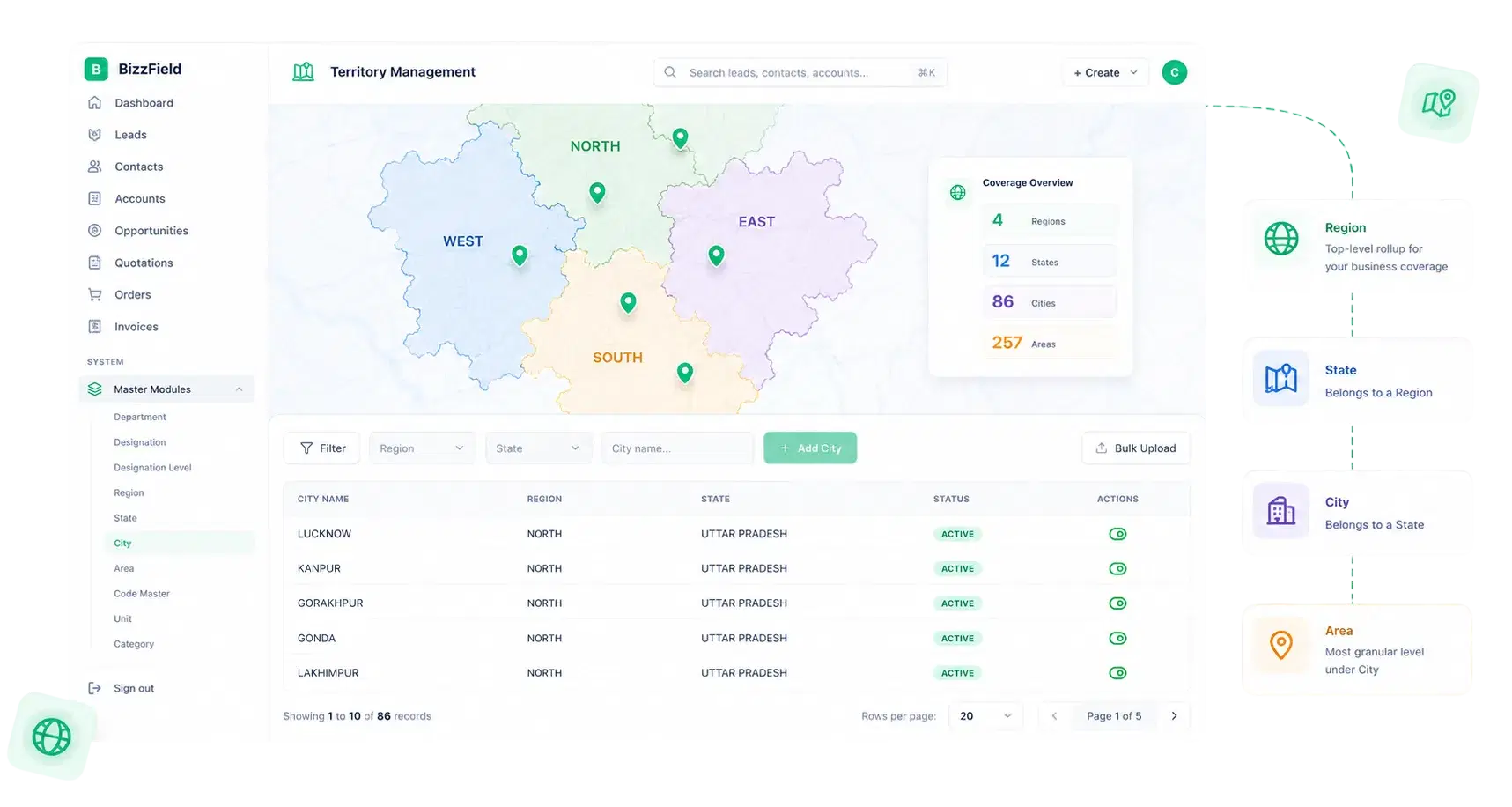
Build your coverage map exactly as your business actually operates on the ground, with every level independently manageable.
Set It Up Once, Maintain It as You Grow
Full CRUD and Excel Bulk Upload
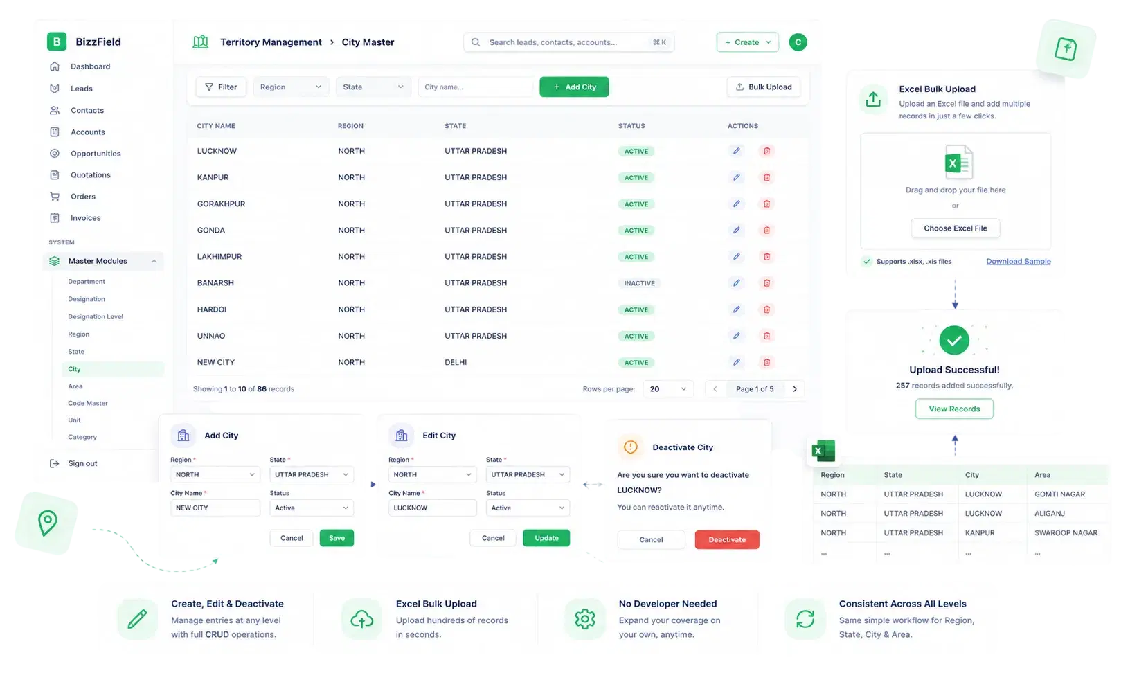
Create, edit and deactivate entries at any of the four levels, or bulk upload an entire region's structure via Excel without a developer or a support ticket.
One Master, Every Record Type
Consistent Tagging Across Every Module
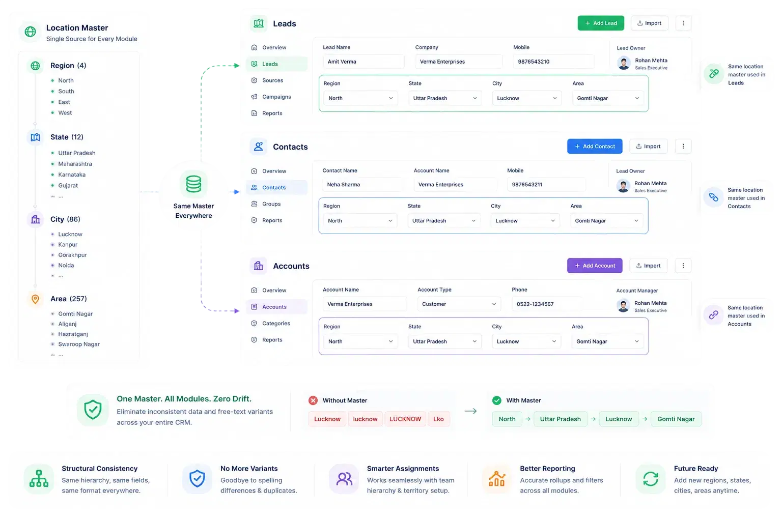
Leads, Contacts and Accounts all pull location from the same Region, State, City, Area master, so data never drifts out of sync between modules.
Geography as an Operational Lens
Location-Driven Filtering and Reporting
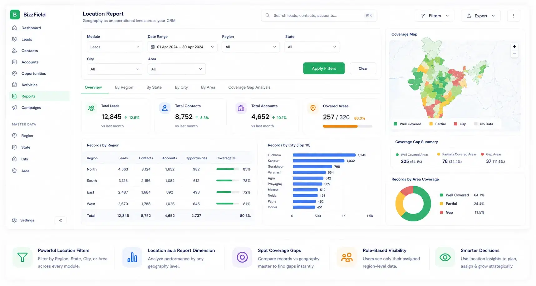
Turn geography into an operational lens across the CRM — filter by location, report by region and spot coverage gaps at a glance.
Why Growing Sales Teams Choose BizzField for Territory Data
One real hierarchy, not a flat text field bent into shape after the fact.
What Territory Structure Looks Like on BizzField
The geography model your team gets from day one.
From Bare Map to Segmented Pipeline
Four steps to a coverage model that every module can filter and report on.
Territory Management — Questions We Get Asked
BizzField uses a four-level geography master (Region → State → City → Area) that you fully control, and tags Leads, Contacts and Accounts by location for segmentation.
Yes. Every level of the geography master — Region, State, City and Area — supports Excel bulk upload, so an existing coverage list does not need to be re-typed by hand.
Yes. All three record types tag location from the same Region, State, City, Area master, so the same territory is always spelled and structured the same way across every module.
Yes. Any of the four geography levels can be used as a filter on Leads, Contacts and Accounts, or as a reporting dimension, making region-wise coverage a query instead of a manual VLOOKUP.
Region, State, City and Area entries can be added, edited or deactivated at any time with full CRUD, so the geography master keeps pace with the business rather than locking you into a fixed set of defaults.
There's no artificial ceiling. Teams typically start with a bulk Excel upload of their existing coverage — a live console today shows 128 areas already mapped across an active hierarchy — and keep adding Regions, States, Cities and Areas as coverage grows.
Put Your Coverage on One Geography Master
See how a four-level Region, State, City, Area hierarchy keeps every Lead, Contact and Account consistently tagged, filterable and reportable from day one.